


1/2
Canton of Valais, Switzerland, 2021.
HIGHLANDERS. THE CAUCASUS & THE ALPS
Chapter I: Geography and nature
2/2
Mount Shalbuzdag, Dagestan, 2016.
HIGHLANDERS. THE CAUCASUS & THE ALPS
Chapter I: Geography and nature


Marina Nikolaevna Petrushina
Candidate of Geographical Sciences, Lecturer at the Faculty of Geography of the Lomonosov Moscow State University
MOUNTAINS
MOUNTAINS
Switzerland is located in the geographical center of the European Alps, Dagestan and the neighboring regions of Azerbaijan are located in the eastern part of the Greater Caucasus. The nature of the Caucasus and the Alps is similar in many ways — these are young mountains, the highest in their countries.
Switzerland is located in the geographical center of the European Alps, Dagestan and the neighboring regions of Azerbaijan are located in the eastern part of the Greater Caucasus. The nature of the Caucasus and the Alps is similar in many ways — these are young mountains, the highest in their countries.
Their axial ridges with steep slopes, Alpine forms, and rocky peaks rise by 3.5 — 4 km or more. In the Eastern Caucasus, the regions of Dagestan and Azerbaijan on the one hand are separated by the watershed of the Main Caucasian Ridge, and on the other are connected by passes, often impassable. In the axial part of the ridges, there are many passes at altitudes of more than 2000 meters (Great St. Bernard Pass, Simplon, Gotthard).
Their axial ridges with steep slopes, Alpine forms, and rocky peaks rise by 3.5 — 4 km or more. In the Eastern Caucasus, the regions of Dagestan and Azerbaijan on the one hand are separated by the watershed of the Main Caucasian Ridge, and on the other are connected by passes, often impassable. In the axial part of the ridges, there are many passes at altitudes of more than 2000 meters (Great St. Bernard Pass, Simplon, Gotthard).
The highest mountain of the Greater Caucasus is Bazardüzü in southern Russia. Its height is 4466 m. The highest point in Switzerland is Matterhorn in the canton of Valais. Its height is 4478 meters and it is also located in the south, on the border with Italy.
There are fewer glaciers in the Caucasus than in the Alps, the snow line is located at an altitude of 3600-4000 m (in the Alps it is 2800-3300 m).
The Gotthard Tunnel (57.1 km) has long been considered the longest railway tunnel in the world. But in 2018, it was bypassed by a tunnel in the Guangzhou metro.
Mount Bazardüzü
Mount Matterhorn
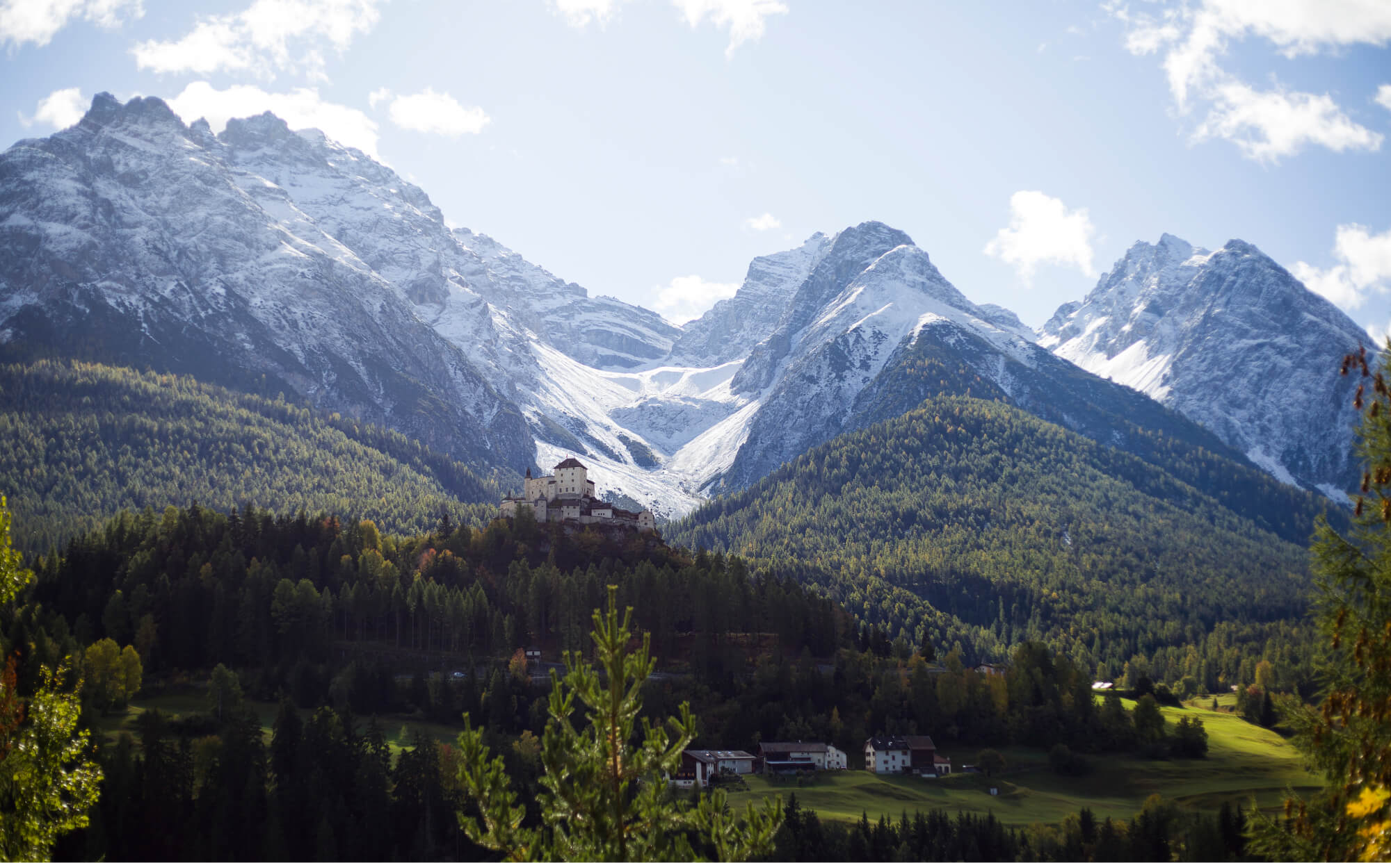
The relief of both mountain systems is dissected and quite sloping, sometimes steep, with numerous rocky outcrops, piles of loose rocks and landslides. Ancient and modern glacial forms — pyramidal peaks, cirques — are typical of the ranges. They are less distinct in the Eastern Caucasus, which is composed of rocks more susceptible to destruction, with a drier climate.
Glacier in the area of Tarasp Castle, Scuol, canton of Grisons, Switzerland, 2021.

The relief of both mountain systems is dissected and quite sloping, sometimes steep, with numerous rocky outcrops, piles of loose rocks and landslides. Ancient and modern glacial forms — pyramidal peaks, cirques — are typical of the ranges. They are less distinct in the Eastern Caucasus, which is composed of rocks more susceptible to destruction, with a drier climate.

Glacier in the area of Tarasp Castle, Scuol, canton of Grisons, Switzerland, 2021.


Marina Nikolaevna Petrushina
Candidate of Geographical Sciences, Lecturer at the Faculty of Geography of the Lomonosov Moscow State University
WATER RESERVOIRS AND CLIMATE
WATER RESERVOIRS AND CLIMATE
Great rivers have their origin in glaciers. They have played an important role in human settlement since ancient times, especially in their extensive areas — the basins.
Great rivers have their origin in glaciers. They have played an important role in human settlement since ancient times, especially in their extensive areas — the basins.
the Caucasus
In the Caucasus, this is the Samur, the second largest river in Dagestan, along the lower course of which the border with Azerbaijan runs. The villages of Mukhakh, Gelmets, Rutul, Khryug, Akhty, Miskinja, and Usukhchay are located on it and its tributaries (Akhtychay). Kasumkent, the center of the Suleyman-Stalsky district, lies on another major river — the Gulgerychay, which begins at the confluence of the Chiragchay and Kurukh, and the villages of Kurakh and Gelmets lie upstream.
Akhty, Akhtychay River, Dagestan, 2016.
Akhty, Akhtychay River, Dagestan, 2016.
Terraced river valleys with green trees near houses, meadows, vegetable gardens and flowering gardens contrast sharply with the rocky slopes of the surrounding ridges. Numerous rivers of the southern slope of the main Caucasian ridge, short with steeply sloping river beds, when leaving the mountains, form the alluvial fans on which most of the Azerbaijani cities are located — Zaqatala, Gabala and others.
Terraced river valleys with green trees near houses, meadows, vegetable gardens and flowering gardens contrast sharply with the rocky slopes of the surrounding ridges. Numerous rivers of the southern slope of the main Caucasian ridge, short with steeply sloping river beds, when leaving the mountains, form the alluvial fans on which most of the Azerbaijani cities are located — Zaqatala, Gabala and others.
THE ALPS
In the Swiss Alps, towns and villages nestle in the valleys of the Rhone, Rhine, Inn, Ticino and their tributaries, and on the shores of many picturesque lakes. There are more than one and a half thousand lakes in the country.
THE Alps
In the Swiss Alps, towns and villages nestle in the valleys of the Rhone, Rhine, Inn, Ticino and their tributaries, and on the shores of many picturesque lakes. There are more than one and a half thousand lakes in the country.
But not only the presence of such a vital source as water attracted people to the valleys and basins, but often a relatively mild climate.
But not only the presence of such a vital source as water attracted people to the valleys and basins, but often a relatively mild climate.

Akhty, Dagestan, 2016.
There are many sunny days (up to 167) in the area of Akhty village, a prolonged growing season (230−250 days), a moderately hot summer and a short winter with unstable snow cover. All this creates comfortable living conditions. The climate in the mountainous part of Dagestan is moderately cold in winter (average temperatures in January vary from -5 to -11 °C), and summer is moderately warm. However, the climate becomes cooler with increasing altitude. At an altitude above 3000 m it is cold.
Precipitation varies with altitude — from 600 to 800 (1000) mm in the highlands, and from 800 to 1600 mm on the windward southern slope in Azerbaijan. Heavy rains and cloudbursts are typical, as a result of which mudslides form. Therefore, some of the mountain villages are located on high terraces and alluvial fans (Kurakh, Akhty) or butte between rivers (Khinalug, Gelmets).

Reuss River, Canton of Uri, Switzerland, 2021.
The Swiss Alps have a moderately humid climate with temperatures between -5 °C (1500 m) and -8 °C (2500 m) in January and 17-19 °C in July.
In the Eastern Caucasus there is more precipitation - on windward slopes up to 2500 m, on leeward slopes and in deep valleys 1000-1500 mm.
Switzerland is rich in water resources. 6% of all fresh water reserves in Europe are concentrated here, which is why it is often called the "water tower of Europe". There are more than 500 hydroelectric power stations in the country, which generate about 56% of the electric energy.
Akhty, Dagestan, 2016.
There are many sunny days (up to 167) in the area of Akhty village, a prolonged growing season (230-250 days), a moderately hot summer and a short winter with unstable snow cover. All this creates comfortable living conditions. The climate in the mountainous part of Dagestan is moderately cold in winter (average temperatures in January vary from -5 to -11 °C), and summer is moderately warm. However, the climate becomes cooler with increasing altitude. At an altitude above 3000 m it is cold.
Precipitation varies with altitude - from 600 to 800 (1000) mm in the highlands, and from 800 to 1600 mm on the windward southern slope in Azerbaijan. Heavy rains and cloudbursts are typical, as a result of which mudslides form. Therefore, some of the mountain villages are located on high terraces and alluvial fans (Kurakh, Akhty) or butte between rivers (Khinalug, Gelmets).
Reuss River, Canton of Uri, Switzerland, 2021.
The Swiss Alps have a moderately humid climate with temperatures between -5 °C (1500 m) and -8 °C (2500 m) in January and 17-19 °C in July.
In the Eastern Caucasus there is more precipitation - on windward slopes up to 2500 m, on leeward slopes and in deep valleys 1000-1500 mm.
Switzerland is rich in water resources. 6% of all fresh water reserves in Europe are concentrated here, which is why it is often called the "water tower of Europe". There are more than 500 hydroelectric power stations in the country, which generate about 56% of the electric energy.
The Swiss Alps have a moderately humid climate with temperatures between -5 °C (1500 m) and -8 °C (2500 m) in January and 17-19 °C in July.
In the Eastern Caucasus there is more precipitation - on windward slopes up to 2500 m, on leeward slopes and in deep valleys 1000-1500 mm.
Switzerland is rich in water resources. 6% of all fresh water reserves in Europe are concentrated here, which is why it is often called the "water tower of Europe". There are more than 500 hydroelectric power stations in the country, which generate about 56% of the electric energy.


HYDROPOWER
HYDROPOWER
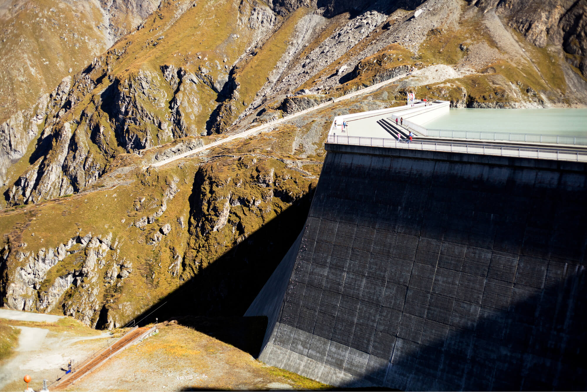
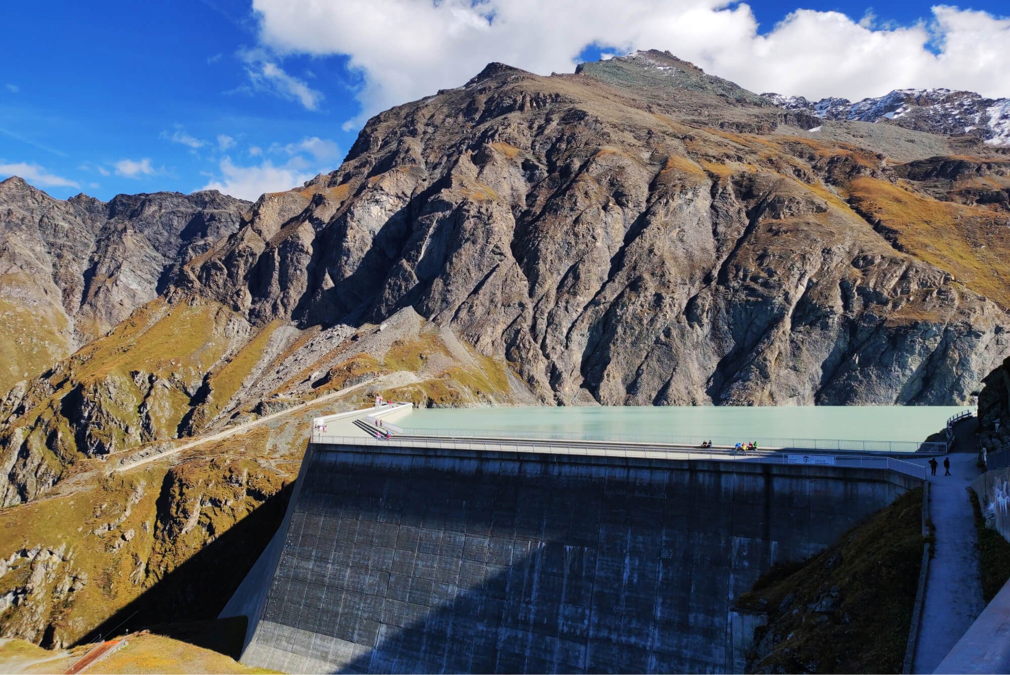
Grande Dixence dam
The Alps
Grande Dixence dam
The Alps
The development of the hydropower industry in the middle of the XX century was one of the main reasons for the rapid economic growth in Switzerland.
The construction of the Grande Dixence dam in the Canton of Valais brought a lot of money to the region and opened high-paying jobs. The dam is owned by a private company that took over the land in a century-old lease. This made the canton a developed agricultural and even partly industrialized area. Today, the dam is part of a large hydroelectric complex in the Rhone River basin, which includes several reservoirs with dams, pumping stations, and diverted hydroelectric power plants.
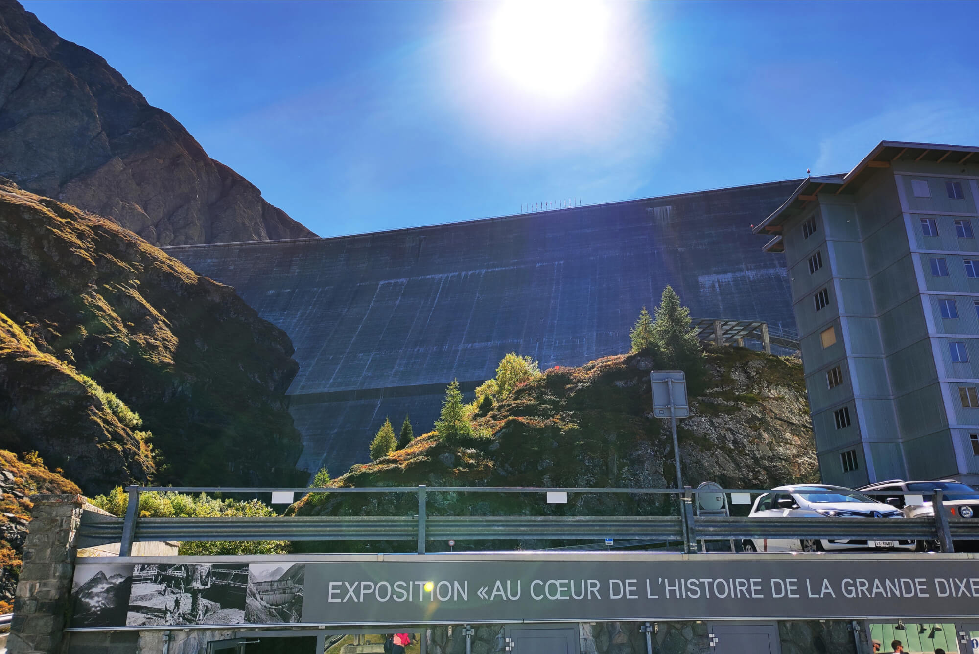
Grande Dixence dam, Canton of Valais, Switzerland, 2021.
1/4


2/4
Grande Dixence dam, Canton of Valais, Switzerland, 2021.
3/4
Grande Dixence dam, Canton of Valais, Switzerland, 2021.


4/4
Grande Dixence dam, Canton of Valais, Switzerland, 2021.
You can explore the inside of the dam on a guided tour: there are tunnels with direct access to the hotel where the workers lived, traces of drilling machines and half-height steps in the corridors.
You can explore the inside of the dam on a guided tour: There are tunnels with direct access to the hotel where the workers lived, traces of drilling machines and half-height steps in the corridors.
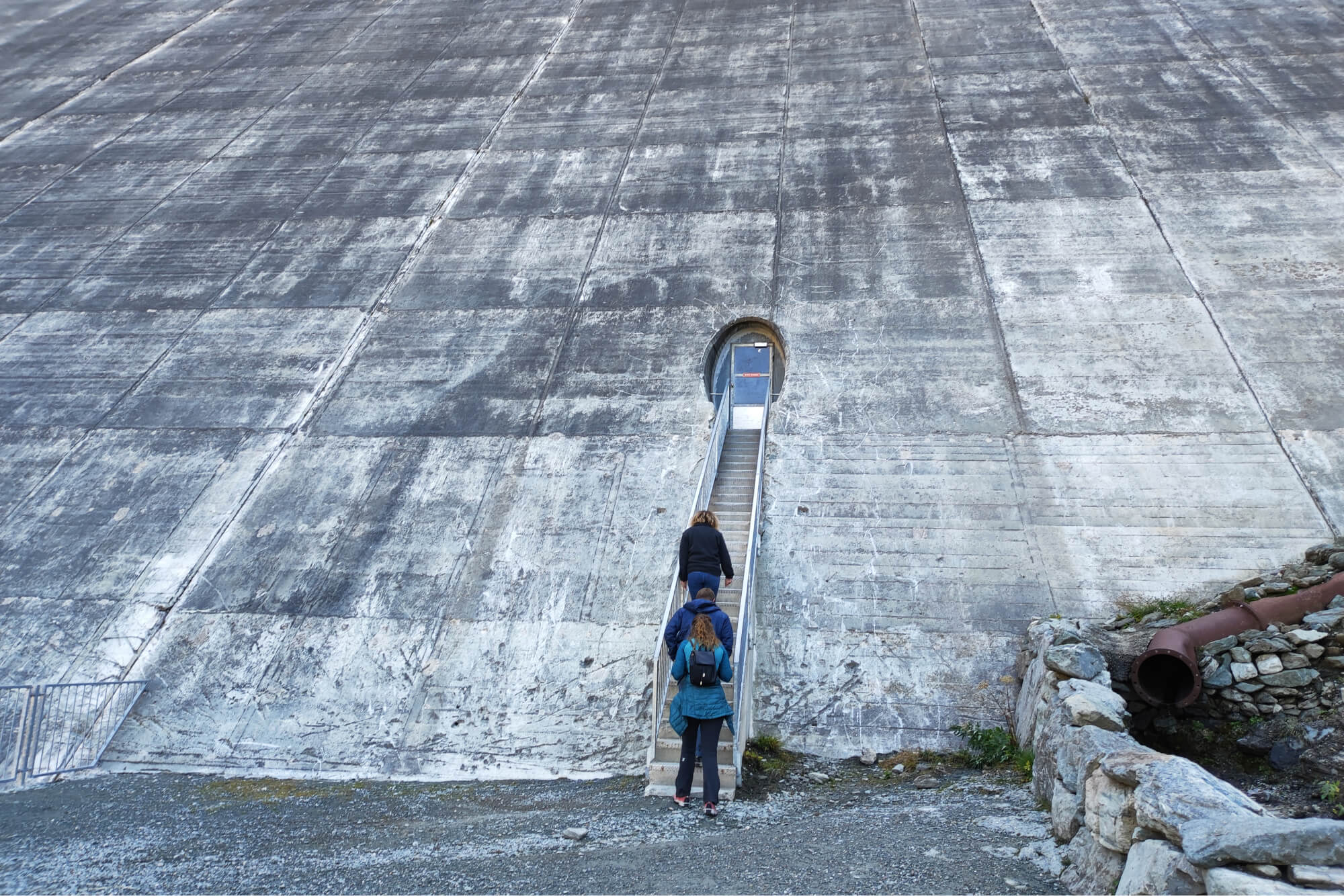
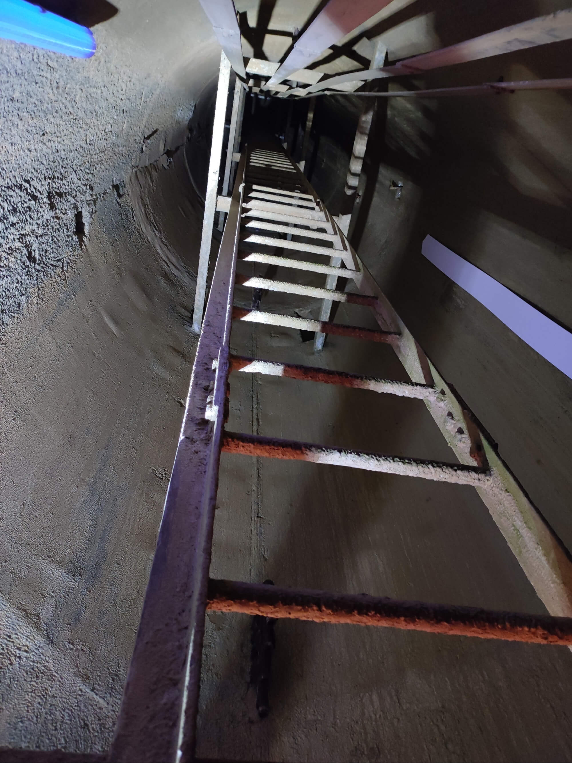
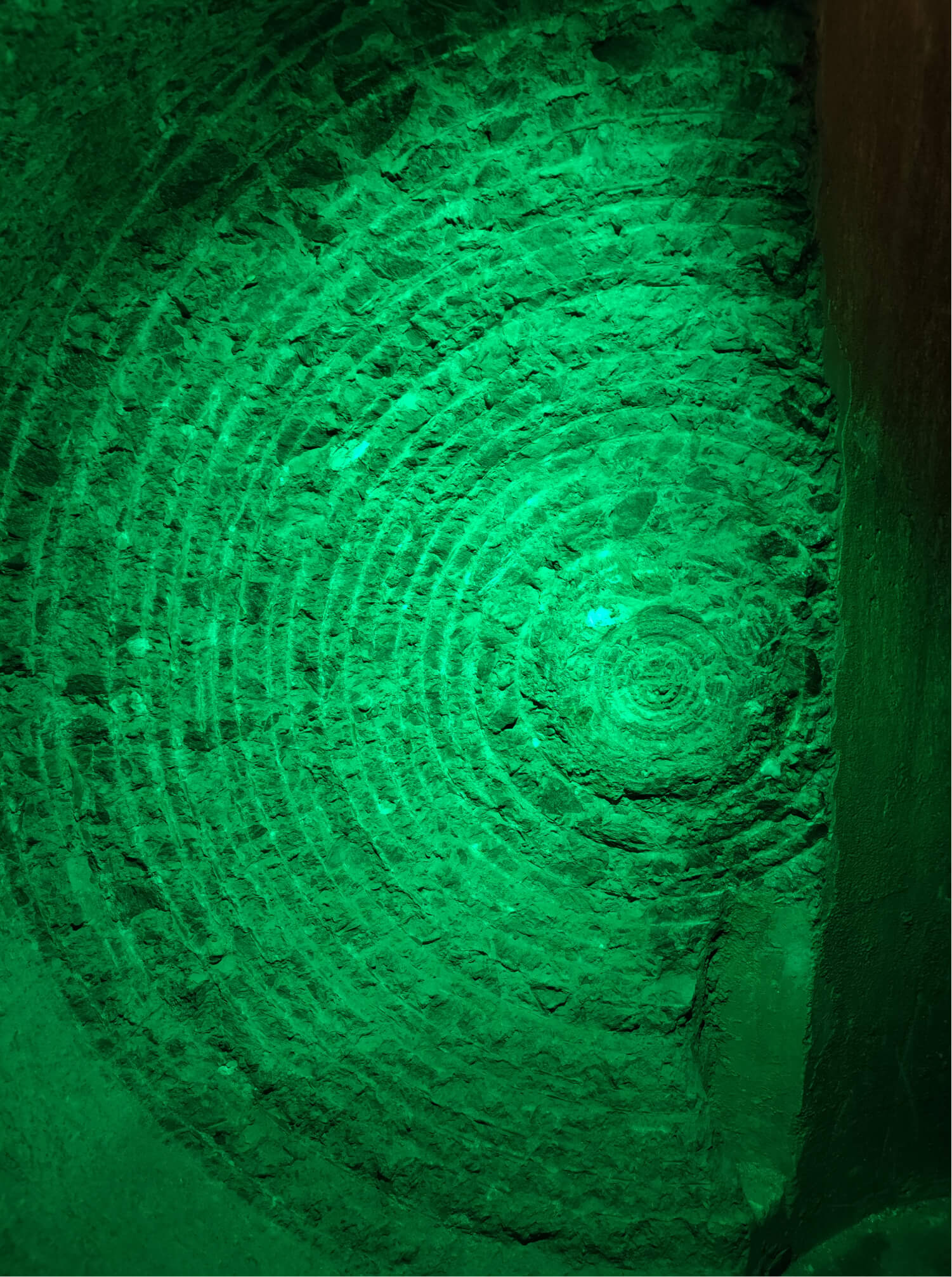
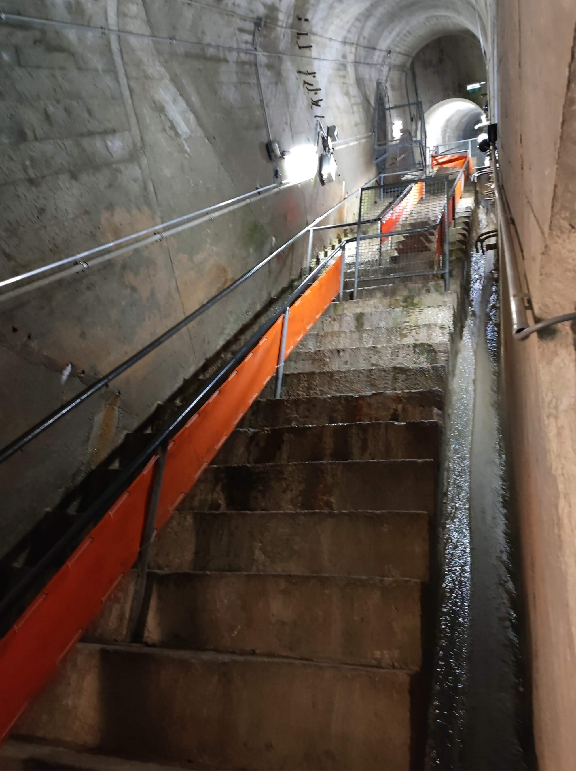
Inside the Grande Dixence dam, Canton of Valais, Switzerland, 2021.
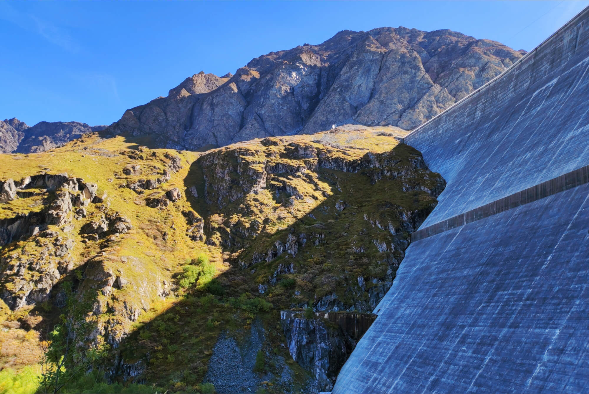
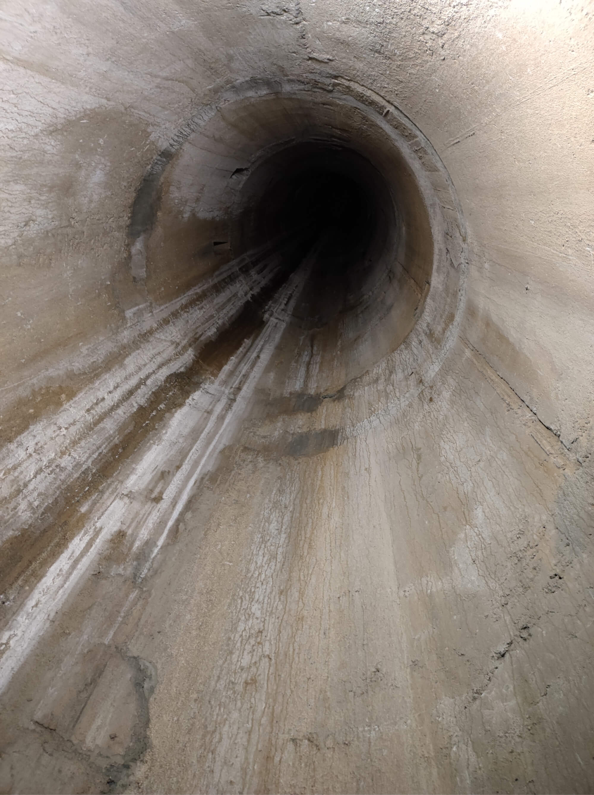
The dam provides electricity to 40,000 homes, far beyond the Valais. The water from 35 melting glaciers collects in an artificial lake more than 5 km long. It flows through tunnels specially bored into the rock. In winter, when the glaciers are not melting, you can walk along some of them. The maximum depth of the lake is 284 meters, and the volume of 400 million cubic meters is reached in the fall, in October. Water is piped at the speed of an airplane to turbines through the mountains at a hydroelectric power station.
The entire reservoir area is considered a protected area — no fishing, swimming or boating is allowed there.
The entire reservoir area is considered a protected area — no fishing, swimming or boating is allowed there.
Pipe for regulating water in the body of the Grande Dixence dam, Canton of Valais, Switzerland, 2021.
The dam provides electricity to 40,000 homes, far beyond the Valais. The water from 35 melting glaciers collects in an artificial lake more than 5 km long. It flows through tunnels specially bored into the rock. In winter, when the glaciers are not melting, you can walk along some of them. The maximum depth of the lake is 284 meters, and the volume of 400 million cubic meters is reached in the fall, in October. Water is piped at the speed of an airplane to turbines through the mountains at a hydroelectric power station.

Pipe for regulating water in the body of the Grande Dixence dam, Canton of Valais, Switzerland, 2021.
The entire reservoir area is considered a protected area - no fishing, swimming or boating is allowed there.
Artificial Lake Dix, Canton of Valais,
Switzerland, 2021.
Artificial Lake Dix, Canton of Valais, Switzerland, 2021.
Chirkeyskaya hydroelectric power station
The Caucasus
Chirkeyskaya hydroelectric power station
The Caucasus
In Dagestan, hydroelectric power stations have also played a significant role in economic development of the region. The peak of their construction occurred around the same time — the 1960s.
For example, the Chirkeyskaya hydroelectric power station in the Buinaksky district is the first arched dam in Russia and the second tallest among all power stations — 232.5 meters. It is second only to the arch-gravity Sayano-Shushenskaya hydroelectric power station. The dam in the gorge has a length of 338 meters along the ridge. Unlike Swiss dams, the hydroelectric power plant is built directly on the lake — the water is not diverted somewhere, but the energy is generated directly on site.


©
Anthropogeos. 2021
Contacts
Our social channels


